
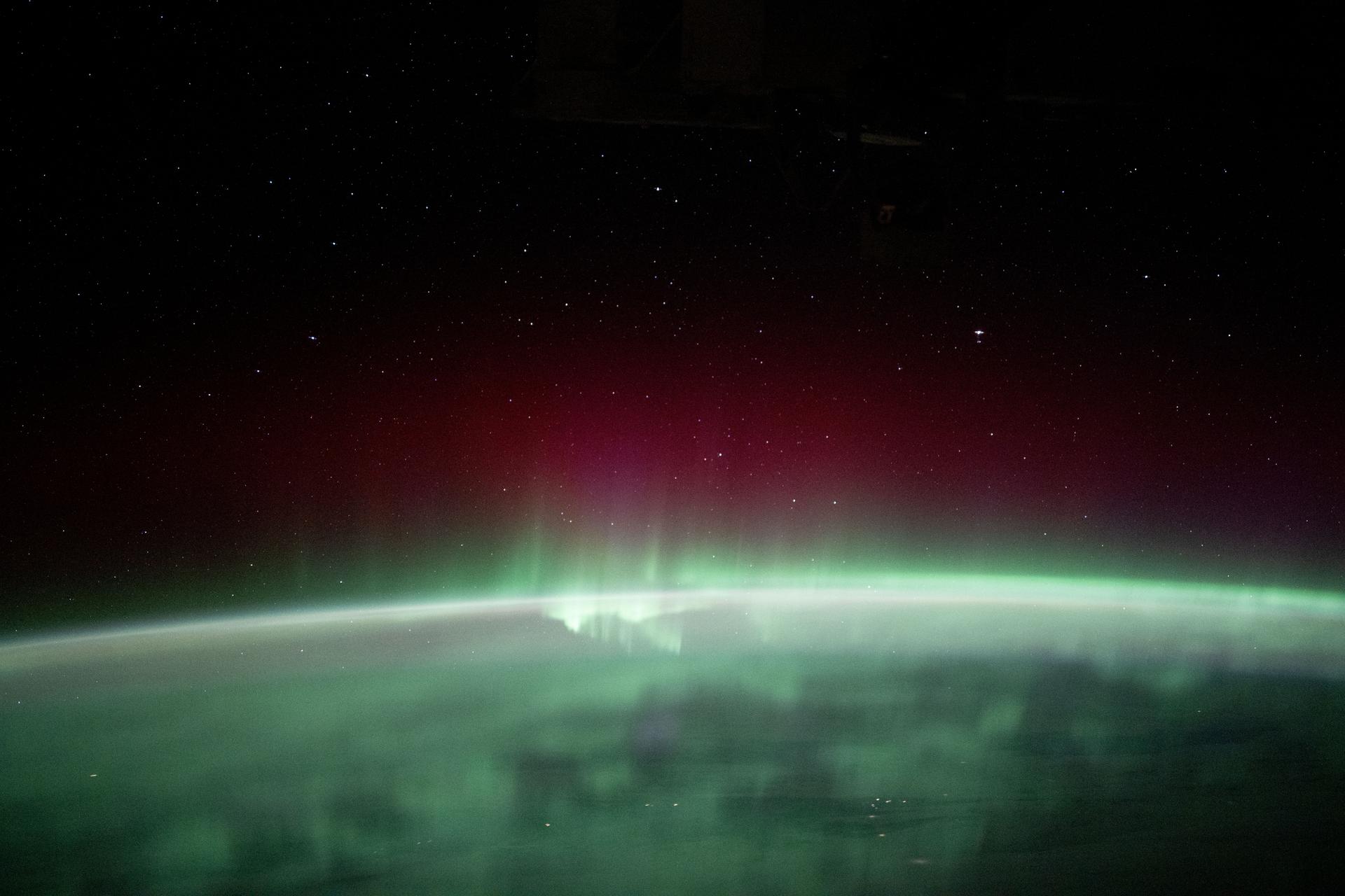
Four days ago, the sky over northern Europe put on a show. On Saturday, October 10, a strong G3-class geomagnetic storm lit up the night. In Lansjarv, Sweden, photographer Petr Horálek caught Mars sitting near the Beehive star cluster (M44) under bright aurora. Now a second, quieter round of space weather is reaching Earth: a stream of fast solar wind from a coronal hole, and possibly a glancing hit from erupted solar material. Whether it adds up to anything worth staying up for depends on which forecast you read.
How the G3 storm unfolded
The alerts feed from NOAA's Space Weather Prediction Center (SWPC) shows the October 10 sequence. An M6.4 solar flare, rated R2 on NOAA's radio blackout scale, erupted from solar coordinates N08W50 and peaked at 1510 UTC. Geomagnetic activity climbed through the afternoon. K-index alerts went from Kp 5 (G1) to Kp 6 (G2), with Kp 6 alerts issued at 1717 and 1837 UTC. Kp 7 (G3, "Strong") alerts followed at 1758 and 1926 UTC.
After that, the forecasts were revised more than once. On October 11, a G2 watch was cancelled at 1702 UTC. At 1911 UTC the same day, SWPC issued a G1 watch for October 13, which pointed to the next disturbance now arriving.
What's arriving now
The newcomer is a coronal-hole high-speed stream. Coronal holes are regions where the Sun's magnetic field opens into space and lets solar wind escape faster than usual. SpaceWeather.com's Wednesday, October 14 front page says "the solar wind has arrived." It reports Earth entering a stream with speeds above 600 km/s and says the stream could spark a minor G1 storm.
EarthSky's October 13 sun update was a bit more optimistic. It said the fast wind from the coronal hole should bring G1 conditions, possibly G2 if a glancing blow from a coronal mass ejection (CME) adds to it. That possible CME comes from two filament eruptions in the Sun's southeast quadrant, one around 22 UTC on October 11 and another around 4:30 UTC on October 12. EarthSky said a minor glancing blow from them was possible on October 14. Its day-by-day outlook calls G1 likely on October 14, then quiet to unsettled conditions (Kp 2–3) on October 15.
For context, EarthSky reported that Kp stayed between 1 and 3 on October 13, so the stream had not yet done much when that update went out.
Where the forecasts split
SWPC's outlook is more cautious. Its 3-Day Forecast issued at 0030 UTC on October 14 says the highest observed 3-hour Kp in the previous 24 hours was 3. The highest Kp it expects over October 14–16 is 3.67, in the 00–03 and 06–09 UT windows on October 14. That is below the Kp 5 threshold for a G1 storm on NOAA's scale. After that the numbers fall: a maximum of 3.33 on October 15 and 1.67 on October 16. The forecast's rationale is blunt: no G1 or greater storms are expected, and it forecasts "no significant transient or recurrent solar wind features."
That last phrase is the clearest disagreement. It appears to mean NOAA's forecasters do not expect either the glancing CME EarthSky described or the coronal-hole stream SpaceWeather.com reports to push activity to storm level.
NOAA's own products also send mixed signals. SWPC still has an active Kp 4 warning (WARK04). It was issued October 13, extended at 2058 UTC, and is now valid until 1200 UTC on October 14. The warning puts the impact area primarily poleward of 65 degrees geomagnetic latitude, with aurora possible at high latitudes such as Canada and Alaska. SpaceWeather.com also quotes NOAA storm probabilities updated at 2200 UTC on October 13. For the 0–24 hour window, those give high latitudes a 20 percent chance of a minor storm and a 20 percent chance of a severe one, and give mid-latitudes a 25 percent chance of active conditions. Those numbers came out a few hours before the more conservative 0030 UTC forecast.
So the timeline matters. The earlier products allowed for storm conditions. The newest 3-day forecast, which we're treating as NOAA's latest word, does not. The G1 calls from EarthSky and SpaceWeather.com were written before or around the time the stream arrived, and the forecasts may change as real-time solar wind data comes in.
So should you go out tonight?
Your latitude decides it.
- High latitudes (Alaska, Canada and similar): This is where the sources point to the best odds. SWPC's Kp 4 warning specifically names Canada and Alaska as places aurora may be visible, and it covers the hours up to 1200 UTC on October 14. The forecast highs are also front-loaded: NOAA's peak Kp of 3.67 for the period falls on October 14, in the 00–03 and 06–09 UT windows.
- Mid-latitudes: The 25 percent chance of active conditions is low, and NOAA's newer outlook doesn't call for a storm. If EarthSky's G1-to-G2 scenario plays out, and especially if the glancing CME arrives, chances would improve. That is a possibility, not the forecast.
- October 15 and 16: Both sources expect things to calm down. EarthSky expects Kp 2–3 on the 15th, and NOAA's maximums fall to 3.33 and then 1.67.
The Sun isn't done
The geomagnetic picture is calming, but the Sun itself is still active. EarthSky counted five flares in the 24 hours before its update: four C-class and one B-class. The strongest was a C1.2 from active region AR4549. It listed sunspot regions AR4548 (magnetically simple, alpha class), AR4551 and AR4554 (both beta class), and put the chance of an M-class flare at 35 percent and an X-class flare at 5 percent.
NOAA's forecast gives a 10 percent chance each day of R1–R2 radio blackouts and 1 percent for R3 or greater. It also gives a 5 percent chance of an S1 solar radiation storm on October 14. Those are not high odds, but they are not zero. The October 10 M6.4 flare that started this episode shows what a single active region can do.
Why It Matters
This week shows something aurora chasers deal with all the time: a big storm makes headlines, and the follow-up forecasts often disagree. When one outlet says "G1, possibly G2" and NOAA's newest forecast says no storm, the honest answer is that conditions are uncertain, and real-time solar wind data will settle it faster than any outlook.
In practical terms: if you're at high latitude, the early hours of October 14 are your best window, and SWPC's own warning backs that up. If you're farther south, check updated alerts before you commit to a cold night outside. October 10 showed that the Sun can still produce strong storms. This week's activity looks milder.