
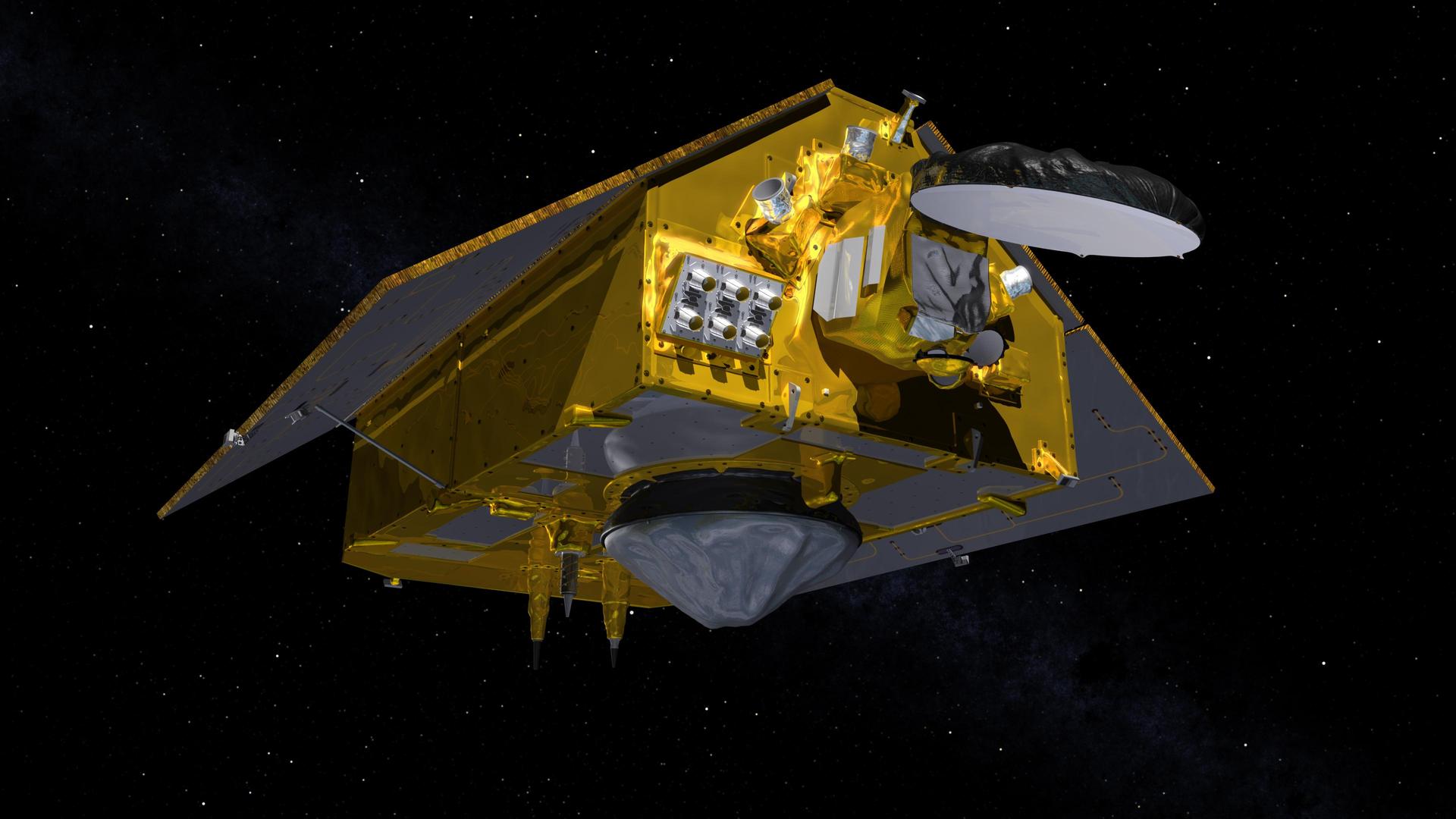
Most satellite missions are judged by what they find. Sentinel-6B will be judged by whether it measures exactly the same way as the satellites before it. On October 30, 2026, EUMETSAT declared the Copernicus radar altimetry satellite operational. EUMETSAT runs it on behalf of the European Commission. Sentinel-6B now carries forward a measurement of global sea-surface height that started in 1992 with TOPEX/Poseidon and continued through the Jason series. The goal is to keep that record going into the 2030s.
The milestone isn't dramatic, but it matters. A climate record is only as useful as its continuity, and each handover between satellites is a chance to introduce a seam into the data. The past year of Sentinel-6B's life was spent making sure no seam appears.
From Vandenberg to the Reference Orbit
Sentinel-6B launched on November 17, 2025, at 06:21 CET on a SpaceX Falcon 9 from Vandenberg. According to ESA, the rocket delivered the spacecraft to orbit just under an hour after liftoff. ESA's mission control centre, ESOC, picked up the satellite's signal at 07:54 CET through a ground station in Inuvik.
The mission is a joint project of the European Commission, ESA, NASA, EUMETSAT and NOAA, with support from the French space agency CNES. That many partners reflects how the sea-level record has always worked: it is a long-running international measurement that no single agency owns.
Flying 30 Seconds Behind Its Twin
Sentinel-6B's twin, Sentinel-6 Michael Freilich, already in orbit, is the current reference satellite. Since December 2025 the two have flown in tandem at an altitude of 1,336 km, with Sentinel-6B trailing by 30 seconds. At that spacing, both altimeters measure nearly the same patch of ocean under nearly the same conditions. Any systematic difference between the two instruments then shows up clearly and can be corrected before the older satellite hands over its role.
That cross-calibration is the point of the months-long gap between launch and operational status. EUMETSAT says Sentinel-6B is expected to become the internationally agreed reference in the coming months, after which Sentinel-6 Michael Freilich will move to a new orbit, ending the tandem flight. Sentinel-6B will then be the world's reference sea-level mission, the benchmark against which other sea-level missions are calibrated.
Across its coverage, the satellite observes up to 95 percent of the planet's ice-free ocean. EUMETSAT says data reach users within about three hours, which is fast enough for weather and ocean forecasting as well as long-term climate monitoring.
What 34 Years of Measurements Show
EUMETSAT's figures put global mean sea level more than 11.5 cm higher than it was in December 1992. The more telling number is the trend. Sea level rose 2.8 cm in the record's first decade and as much as 4.0 cm in the most recent one. The rise is speeding up, and detecting that change in rate depends on the record being consistent across several generations of satellites. A calibration error of a few millimetres between missions could hide a real acceleration or invent a fake one.
That is why Sentinel-6B's main job is to be exactly as good as its predecessors, with no unexplained offset. The tandem flight is how the partners check that it is.
Already at Work During a Strong El Nino
The satellite was in use before it was officially declared operational. NASA reported that Sentinel-6B began delivering low-latency data to scientists on July 15. That timing coincided with what oceanographers expect to be a historic El Nino. Both satellites are supplying sea-level data during the event.
Sea-surface height is useful here because warm water expands. A swell of warm water moving east across the Pacific appears as a measurable bump in the ocean surface. Josh Willis, the project scientist at NASA's Jet Propulsion Laboratory, described this El Nino as one that "was a late-bloomer." He said it is now reaching a strength similar to the 1997 and 2015 events. Having two reference-class altimeters watching the same ocean during an event of that size gives scientists unusually well-checked data on it.
Why It Matters
Sea-level data can seem abstract until you consider who lives near the water. EUMETSAT's Phil Evans noted in the operational announcement that around 900 million people live in low-lying coastal areas. For them, the long-term trend affects decisions about infrastructure and planning. The short-term data, delivered within hours, affects storm and ocean forecasts.
Sentinel-6B serves both uses. Over the long term, it keeps a 34-year record unbroken at a time when the record shows the rate of rise increasing. Day to day, its data go into weather, El Nino and ocean forecasting systems. The months spent in tandem with its twin are what allow the new satellite's numbers to be trusted as a continuation of the old ones.
The mission also shows how this kind of measurement survives. No single satellite lasts 34 years. The record exists because agencies on both sides of the Atlantic have kept launching replacements, overlapping them and calibrating each against the last. Sentinel-6B is the latest of those handovers, and it is intended to carry the record into the 2030s.