
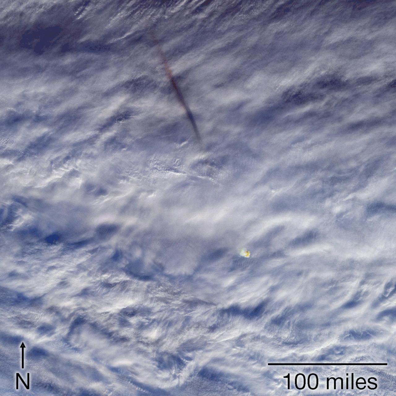
At 02:13 UTC on April 1, 2026, a space rock hit the upper atmosphere over the South Atlantic, off the coast of Argentina, and burned up as a bolide. It reached its peak brightness about 90.5 kilometers (nearly 60 miles) up. US government sensors detected it, and it was catalogued in NASA's public fireball database.
Those sensors, which are military space-based surveillance satellites, are the primary source of such detections. What makes the April 1 fireball different is that the military sensors had company. Two civil weather satellites, NOAA's GOES-East and the MTG-I1 spacecraft (Meteosat Third Generation Imager-1), both caught the flash with instruments built to map lightning. Because the two satellites watched from different locations in geostationary orbit, researchers could trace the fireball's trajectory from two vantage points.
A Space.com feature published November 1 uses this event and several others to explain how planetary defense now works. Classified detections, a public NASA catalog and repurposed weather instruments all feed into a picture of what is hitting Earth's atmosphere and how hard.
The black box at the center
The anchor of the system is the fireball database run by NASA/JPL's Center for Near Earth Object Studies (CNEOS). CNEOS is open about the database's limits. Its fireball and bolide data are "derived from U.S. Government sensor detections" and are "provided to CNEOS for public release." CNEOS does not independently verify or reanalyze those events, and reported parameters will be revised if updated information is provided to the center.
In practice, the data passed to CNEOS includes a measurement of total radiated energy and an estimated entry speed, along with the time and location. ESA describes space-based military surveillance satellites as the primary source of such detections, so a large share of what the world knows about meter-scale impactors arrives through a government channel that outside researchers cannot independently check on their own.
Usually that is acceptable. Sometimes a number needs a second look.
A velocity that needed a second opinion
The April 1 event was one of those cases. In ESA's July 28 account, Juan Luis Cano of the agency's Planetary Defence team said the reported velocity components implied such a high entry speed that independent verification was required to later assess the object's possible origin. Speed matters because it bears on where an object came from, its orbit and how much energy it released.
The lightning imagers provided that check. GOES-East carries the Geostationary Lightning Mapper (GLM), and MTG-I1 carries the Lightning Imager. Both watch from about 36,000 kilometers above the equator and detect millions of lightning flashes a day. Researchers used the two datasets together in a paper published in the Research Notes of the American Astronomical Society.
The instruments were built to find lightning, so the first problem is telling a meteor apart from a storm. According to ESA, fireball detonations have clear linear paths and a gradual increase in intensity before fading, unlike the fixed points of lightning flashes. ESA's Niels Rubbrecht noted that detecting fireballs with the Lightning Imager requires rethinking a processing chain originally designed to reject non-lightning events.
The result was a partial confirmation with a twist. Applying two independent velocity models to the combined satellite observations, the team found a peak-brightness location and direction consistent with the US government findings, but a velocity magnitude around 18 percent lower. ESA says that helps constrain the object's likely origin to the outskirts of the Solar System. Next, the team plans a detailed analysis, including an energy estimate from low-frequency acoustic records.
ESA says the larger goal is to separate fireballs from lightning routinely and build a global inventory of these events, to improve knowledge of the very small-object population in near-Earth space.
What falls through the cracks
The government sensors do not report everything. The Space.com report describes an April 24, 2025 fireball over south-central Alaska that was not reported by US government sensors in the CNEOS database. It was still well recorded by ground instruments. A network of 37 seismic stations, 16 single infrasound sensors and four infrasound arrays recorded 30 ballistic and fragmentation arrivals. Doppler weather radar also detected falling meteorites, and independent video captured the event optically.
Elizabeth Silber, a senior research and development physicist at the Department of Energy's Sandia National Laboratories, told Space.com the event was reconstructed almost entirely from civil and scientific observations. Seismic and infrasound data constrained the trajectory and acoustic energy, video supplied independent optical information, and radar found material from the fireball falling to Earth. The Alaska case shows that these networks can capture an event the orbital sensors did not report. It also suggests that the public catalog is a sample of what happens rather than a complete census.
The catalog does capture large events. On May 20, 2023, an object estimated at about 3.7 meters (12 feet) across plowed through the atmosphere over northwest Queensland, Australia, accompanied by sonic booms. US government space-based sensors caught it. Researchers later found that it underwent catastrophic fragmentation, producing one of the 20 most energetic events reported by CNEOS since 1988 and the most energetic seen over Australia. The energy was equivalent to a 7.1-kiloton explosion.
Why It Matters
Planetary defense is not only about finding an object before it reaches Earth. As Silber put it, it is also about understanding what happens during atmospheric entry: how an object fragments, where it deposits its energy, how accurately its trajectory can be reconstructed and whether material survives to the ground. Each real event is a test of the methods and models used to answer those questions. ESA also notes that small imminent impactors are now routinely detected before they enter the atmosphere, and that pre-impact telescope observations can be combined with fireball camera networks, radar, infrasound, seismic stations and space-based sensors.
The Space.com piece also points to a security issue. NASA's Rob Landis, a planetary defense specialist, cautioned that it would be a horrific tragedy if any nation misinterpreted a natural event as a preemptive strike, and stressed the importance of distinguishing natural events from human-made ones. Landis said that with two civilian resources, scientists can discuss such events more openly. Silber made a related point about cross-checking: when a US government detection exists, civil data can independently validate it and add detail, and when one does not, civil networks can still provide a surprisingly complete reconstruction.
The lightning imagers matter because of that cross-check. Landis noted that lightning-watching instruments were not designed to detect bolides, and called what they provide opportunistic bonus science. On April 1 the civil satellites and the government sensors recorded the same event, and the civil data could test the government's velocity. For the analyst, that is the practical lesson: a catalog entry is a starting point, and independent observations are what turn it into something others can verify.